Detroit River- W. Lake Erie CWMA
Background
Using long-term monitoring to build partnerships and set management priorities
GLPC Editor’s Note: This case study showcases monitoring of Phragmites infestations and ecosystem impacts to determine the effectiveness of control methods and make data based decisions about future treatments.
Author: Chris May
The Detroit River Western Lake Erie (DRWLE) Cooperative Weed Management Area (CMWA) covers a landscape dominated by industrial, agricultural, and urban development. However, over 10,000 acres of critical wetlands remain in conservation ownership along the Lake Erie coast from the Detroit River to the Michigan-Ohio state line. These wetlands provide economic, recreational, and ecosystem benefits to over 6 million people in the Detroit, MI andToledo, OH metropolitan areas.
Historically, the wetlands consisted of a diverse matrix of emergent marsh, open water, forested swamp, and sand coastline. When the DRWLE CWMA began, thousands of acres of the coastal wetlands were dominated by a monoculture of non-native Phragmites, which, in places, created an impenetrable barrier more than 20 feet tall.
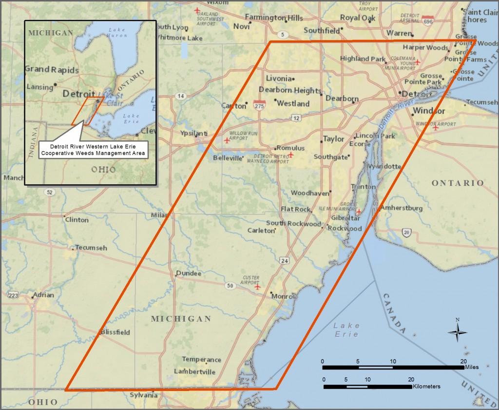
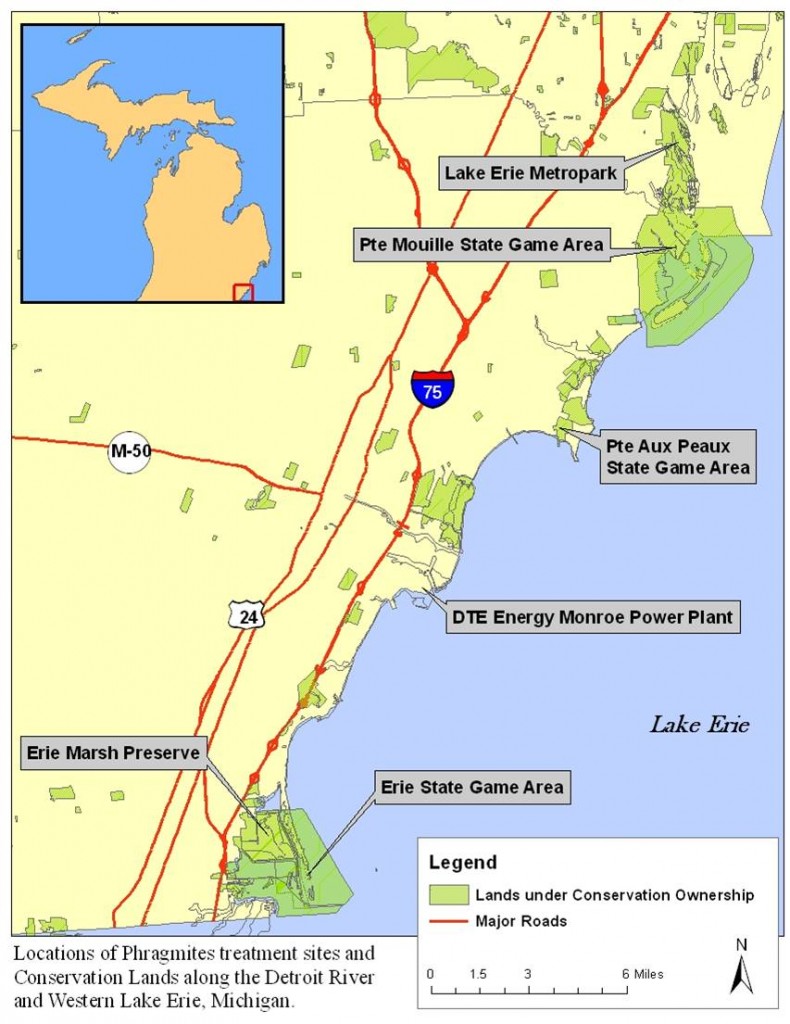
The Detroit River Western Lake Erie Cooperative Weed Management Area is located along the Detroit River and Western Lake Erie in Southeast Michigan
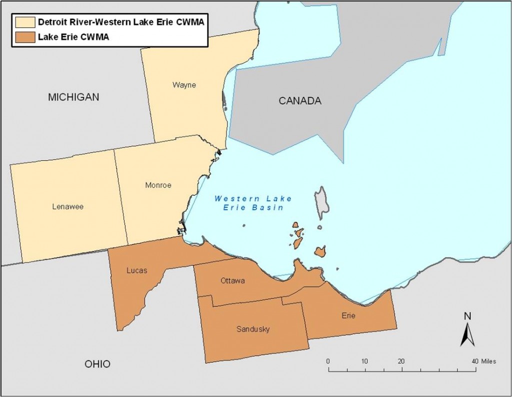
Together, the DRWLE CWMA and the Lake Erie CWMA cover the entire Western shoreline of Lake Erie
The DRWLE CWMA was established in 2011 to prevent and control invasive plant species in Monroe, Wayne, and the eastern half of Lenawee Counties in Michigan. The partners agreed to meet annually to discuss priority areas for management, and cooperate by sharing resources for mutual benefit.
Partnerships and Administration
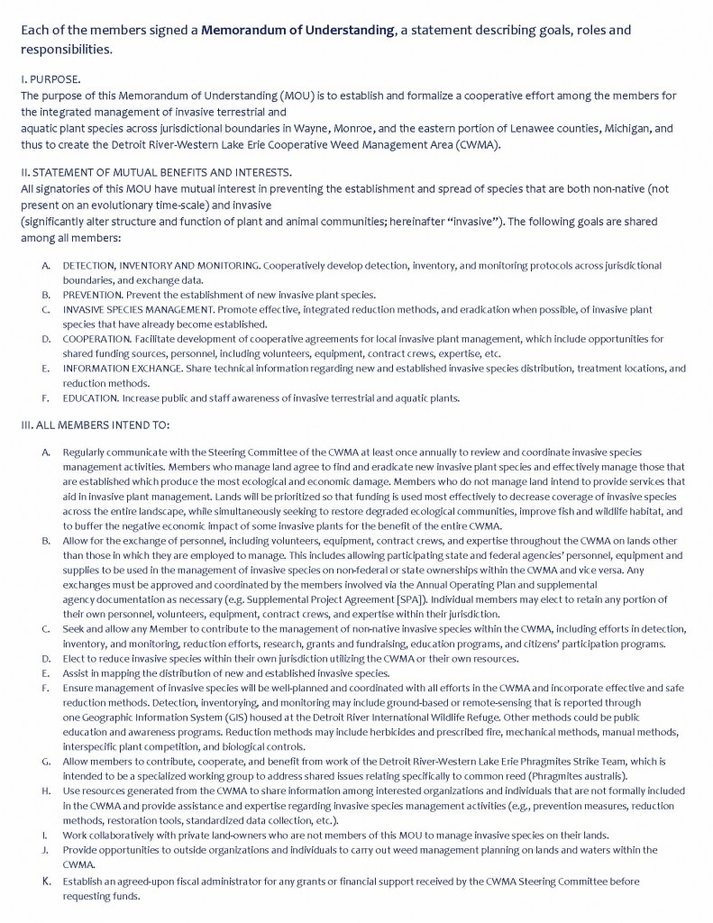
The DRWLE CWMA is a collaborative effort of 13 members comprised of federal, state, regional, and local government agencies; environmental organizations; businesses; and universities. In 2011, when the CWMA was formed, the partners signed an MOU (Memorandum of Understanding) outlining goals, expectations, and responsibilities. The MOU directs the CWMA’s focus towards prevention through detection, inventory, monitoring, and education.
Prior to formation of the DRWLE CWMA, agency personnel were working on Phragmites management, but were not coordinated, did not share resources, and rarely communicated. These partnerships improved communication, results, coordinated and consistent treatments, and monitoring. Collaboration also resulted in more competitive grant proposals, and the ability to share long-term management responsibility among partners. However, communication between partners during the field season can be slow due to competing priorities, and limited resources require that only the highest priority grants and projects be undertaken.
Collaboration between The Nature Conservancy, Michigan DNR, Huron-Clinton Metropolitan Authoity, and U.S. Fish and Wildlife Service has resulted in maximized efficiency for Phragmites management. A cooperative agreement among key partners governs the use of a Marsh Master amphibious vehicle and a “Phragmites Strike Team” was created using staff and equipment, which collectively manage Phragmites in large areas.
Eastern Michigan University (EMU) has been the primary research partner in this project. Prior to CWMA establishment, EMU was completing a large research project that resulted in detailed habitat and Phragmites distribution maps across nearly all member lands. Important publications and theses resulted from this work regarding the impact of Phragmites and its management, along with multiple functions of coastal wetlands that improve the quality of work currently being executed.
During the first five years of the project, the CWMA received funding from the Great Lakes Restoration Initiative (GLRI) through both the U.S. Fish & Wildlife Service and the Environmental Protection Agency, and the Michigan Invasive Species Grant Program, in addition to in-kind contributions from primary partners. As a result of those large federal grants, the CWMA has not struggled with personnel, equipment, and funding. Funding received by the CWMA is administered through a fiduciary, and The Nature Conservancy has served as fiduciary for the two GLRI grants received to date. The International Wildlife Refuge Alliance is serving as fiduciary for the current state MISGP grant.
DRWLE CWMA Members
BASF Corporation
DTE Energy
Ducks Unlimited, Inc.
Eastern Michigan University
Huron-Clinton Metropolitan Authority
International Wildlife Refuge Alliance
Michigan Department of Natural Resources, Wildlife Division
Monroe Conservation District
Southeast Michigan Council of Governments
Stewardship Network
The Nature Conservancy
U.S. Fish and Wildlife Service, Detroit River International Wildlife Refuge
Wildlife Habitat Council
The DRWLE CWMA Memorandum of Understanding with partners
Management Objectives
While landowner agencies retain control of objectives on their lands, management objectives are determined by consensus among CWMA partners and include:
- Biodiversity: Increase and restore native plant and animal diversity; improve travel corridors and habitat for animals; and increase the value of high quality wetlands to native species.
- Recreation: Coastal wetlands are important for a variety of recreation values on public lands, including views of the lake and wetlands while recreating, bird watching, waterfowl hunting, and kayaking/boating. Management should also result in improved and increased public use.
- Waterbird Habitat: Waterfowl hunting is a primary goal of USFWS and MDNR. Phragmites degrades habitat and reduces recreational opportunities.
- Reduced wildfire risk: Wildfires threaten life and property and Phragmites creates conditions for particularly extreme fire conditions.
- Opportunities for public education; adaptive management and development of best management practices; and research.
Prioritization
The process of identifying sites for Phragmites treatments is based on many factors that include: conservation ownership, existing partner priorities, large ownership tracts, the capacity for long-term management, the presence of water control infrastructure, and key private landholdings adjacent to conservation ownership or with large acreage.
In 2009 and 2010, Eastern Michigan University established a GIS database that captured characteristics of the plant communities where there is now annual Phragmites control. This provides a base-line condition of these lands from which to evaluate progress. This data allowed the CWMA to focus on restoring large tracts of coastal wetlands and ensured long-term management.
Policy and Regulations
In 2011, CWMA Partners signed an MOU, which identified the partners, established the CWMA purpose and objectives, and outlined Steering Committee organization and responsibilities. The CWMA Steering Committee sets the annual operating plan, decides on priorities, discusses challenges and provides administrative oversight of the CWMA. Partners coordinate applications for state permits (i.e., MDEQ Aquatic Nuisance Control permit, etc.). Documents coordinated between members often require multiple agency reviews (including legal reviews), many edits, and results in a long process for approval and signatures from key partners.
Communication and Outreach
DRWLE CWMA has not focused on communication and outreach because grant funding sources secured to date have not allowed an emphasis on these items. The CWMA does have a website hosted by Eastern Michigan University at http://driwr.emich.edu/. CWMA partners have given presentations of the work, successes, and lessons learned at professional conferences, local community meetings, and webinars.
Management
A collaborative management strategy allows for a variety of treatment options and methods that support both integrated pest management and adaptive management principles.
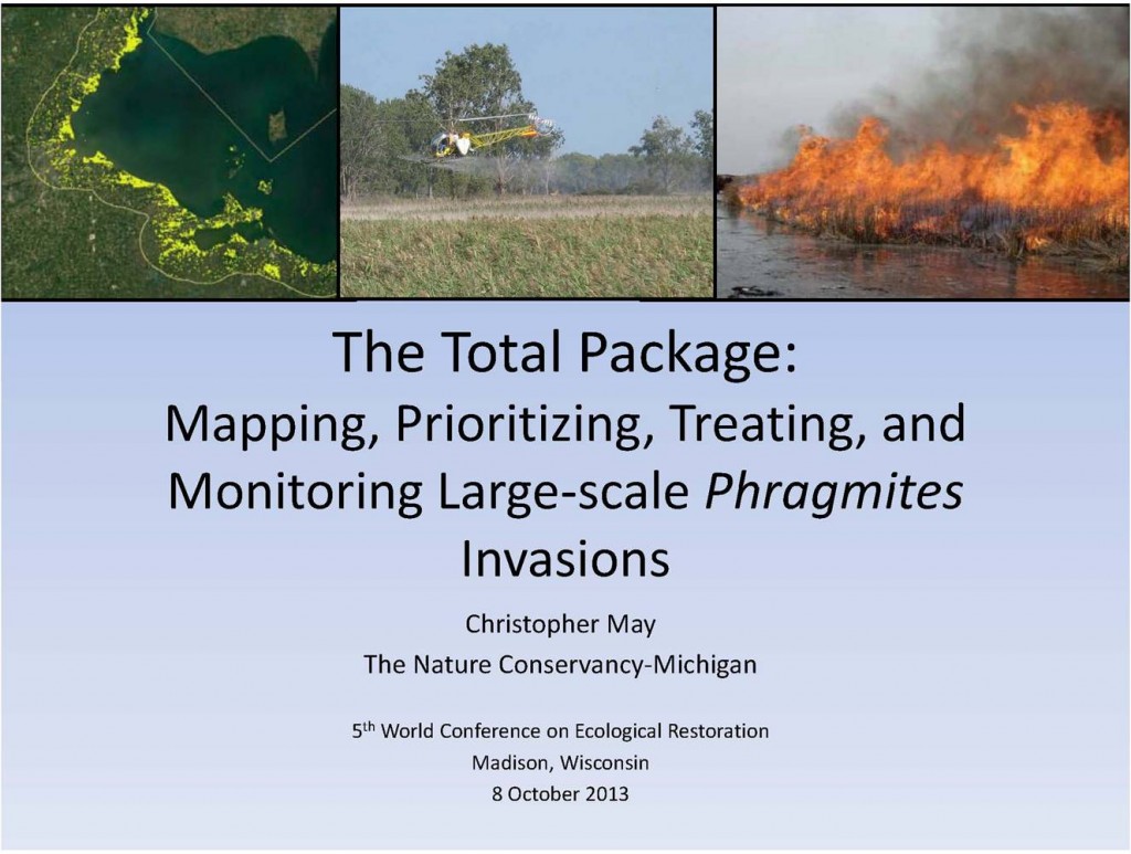
The CWMA initially prioritized areas with large acreages and dense stands of Phragmites. The majority of treatments undertaken were aerial herbicide applications using contacted helicopters. The herbicide was a mix of glyphosate, imazapyr, and a surfactant. Removal of standing dead biomass, following herbicide application, varied based on agency capacity and resources, and surrounding wild land-urban interface considerations such as the presence of residential areas or marinas. In some areas standing dead biomass was removed using prescribed fire and mowing or left to decompose.
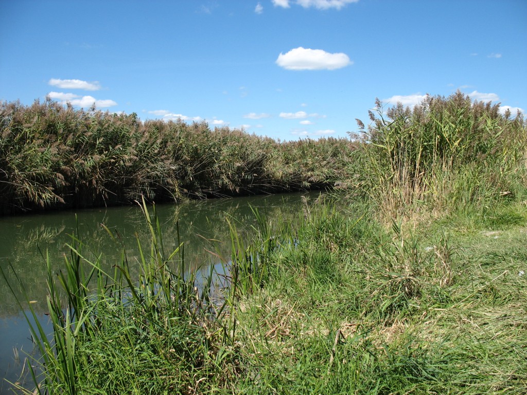
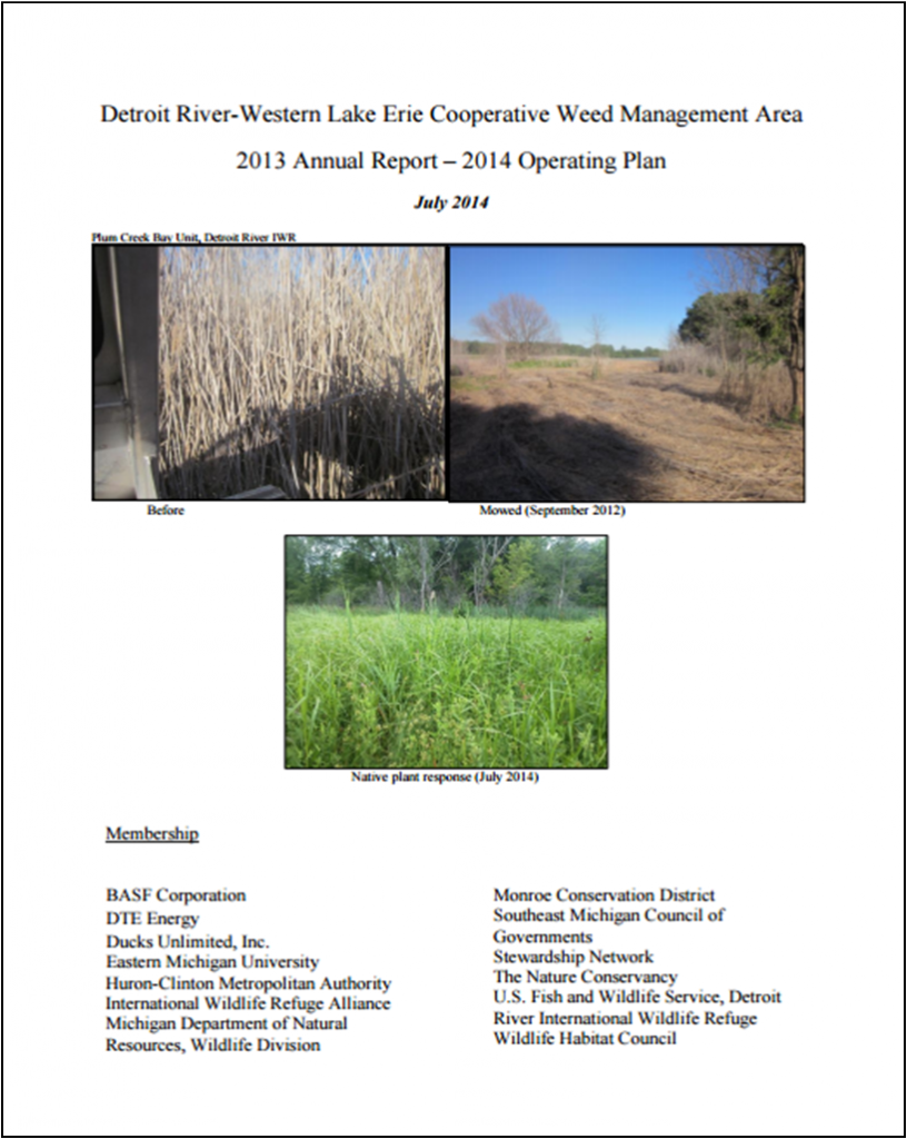
Non-native Phragmites before treatment.
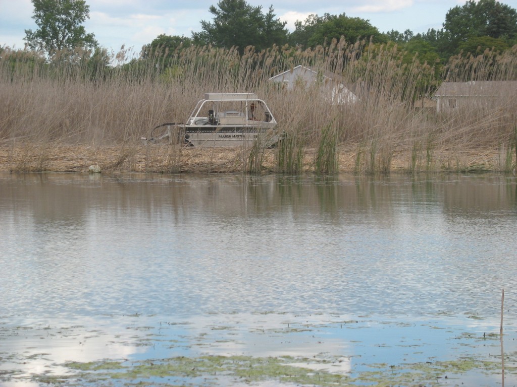
Marsh Master mowing non-native Phragmites
Follow-up herbicide treatments in subsequent years, have been aerial and ground-based applications using ATVs, Marsh Master, and Argos. As the density of Phragmites decreases, backpack spraying and hand-wicking will be used for more selective treatments, especially in areas where native plants are recovering. Flooding is also being used in areas with water management capacity. However, because of the wildland-urban interface and lack of water management capacity in some areas the best management options may not be available or reasonable for use. Additionally, some methods (e.g., prescribed fire) require specialized training and tools.
The Marsh Master amphibious vehicle, purchased with grant funding, is used for mowing Phragmites, supporting prescribed burns, and spraying herbicide. This equipment resource will remain with the CWMA after the grant period, providing a critical and efficient tool for continued long-term management of Phragmites.
In 2015, the CWMA began a new effort to survey, map, and control a suite of additional invasive plant species in coastal wetlands.
Monitoring
Ecosystem research experiments and remote sensing studies, conducted from 2010 through 2013, assembled a team of Eastern Michigan University wetland scientists, biologists, geographers, remote-sensing specialists and their students to identify and map Phragmites. Biological field research was conducted at sites selected in consultation with Detroit River International Wildlife Refuge managers and remote sensing studies and mapping was conducted at all of the refuge management units. Research findings are being used for developing management policies regarding conservation, rehabilitation, and restoration and for identifying best practices for the control and eradication of Phragmites from the refuge ecosystem.
The project focused on several major tasks: 1) developing and validating remote sensing protocols for monitoring Phragmites distribution, 2) mapping habitats within the refuge using remote sensing and ground truth data, 3) assessing the effects of Phragmites invasion and Phragmites removal efforts on wetland ecosystem function, and 4) publishing the results of the study using a GIS-based interactive map viewer platform to inform and aid management activities at the refuge.
A series of 19 transects have been established in areas to document a broad range of plant communities and Phragmites cover. These serve as the base-line condition from which managers can evaluate their management effectiveness. Monitoring information is published through a series of field reports available on the CWMA website. Due to the large acreages that receive treatment, most lands are visited with the intent to rapidly evaluate the success of previous treatments and the extent of Phragmites, as well as native plant regeneration.
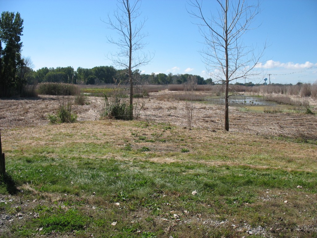
The results of treatment at the Toledo Beach Marsh in 2013
During monitoring, land managers must evaluate the potential use of prescribed fire, mowing, or slow decomposition as well as how to prescribe further herbicide treatments. These decisions require knowledge of the local ecology and natural communities, public use considerations, rare and endangered species, and logistics. Therefore, monitoring the coverage of Phragmites is only one piece of information, albeit an important one, to determine the most efficient type of operations required to continue meeting management objectives.
Additional monitoring methods, such as photo monitoring, convey success more dramatically than a table of numbers. Anecdotal observations have also been made during field visits, following Phragmites treatment, to note if any of the species documented are of conservation value. All monitoring methods should extend beyond grant periods to be truly representative of results.
Data and Information Integration
Eastern Michigan University has established the base-line distribution of Phragmites on most member lands but on-going treatments result in the data becoming out-dated quickly. Nevertheless, this baseline is critical to evaluating whether long-term objectives are being met. Current coverage and changes in plant communities can be evaluated periodically, and within specific areas of interest. Treatment data from all partners are maintained in a GIS database, which includes information on land ownership, and detailed treatment information including who conducted treatments; what treatment occurred and when; and herbicides used and rates. These data are entered annually and capacity is provided by USFWS and EMU.
The Michigan Invasive Species Grant has enabled the CWMA to input quantitative data, on the distribution and patch characteristics of Phragmites, and other priority invasives in GIS and the Michigan Invasive Species Information Network. This method of compilation allows partners to quantify success to funders and track the effectiveness of different management regimes over time.
Because all of the data is stored in one database, this improves the ability of managers to see all treatments within the CWMA landscape and track effectiveness over time. However, compiling that data can be a challenge because it is often in different formats and it can be a challenger to get all the partners to report their activities.
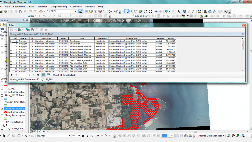
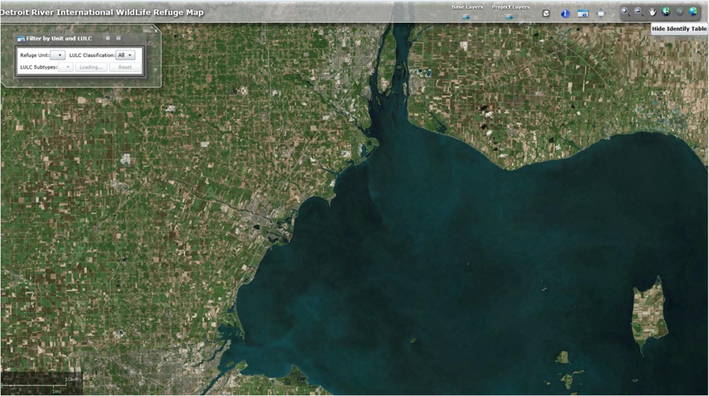
The DRWLE CWMA uses GIS to manage multiple data sets and track treatments over time
References
Thank you!
The GLPC would like to thank the following case study authors and contributors for their hard work and commitment to a great product.
Chris May
Michigan Restoration Director
The Nature Conservancy
cmay@TNC.org
